Drones dont just take pictures, they capture a wealth of data about your crops health. But how do you know which data is best to use?
RGB Sensors Vs. NIR Sensors - Which Is Better for Measuring Crop Health?
Kyler Olson | Botlink
Reprinted with permission from Botlink:
Drones don’t just take pictures, they capture a wealth of data about your crops’ health. But how do you know which data is best to use? In this post, we will compare RGB and NIR imagery and explain which we prefer to help you keep your fields healthy and improve yields.
Let's start at the beginning. What types of drone cameras are used for identifying crop variability?
RGB Cameras
The human eye is sensitive to red, green, and blue (RGB) bands of light. Most standard drones come with cameras that capture the same RGB bands so the images they produce recreate almost exactly what our eyes see. If you are just starting out using drones on your farm, it's OK to start with RGB cameras since they are fairly cheap and most consumer drones like the DJI™ Phantom and DJI™ Inspire systems come equipped with them off the shelf. RGB cameras are good for creating orthomosaic maps that show your entire field at once, and they can capture aerial videos.
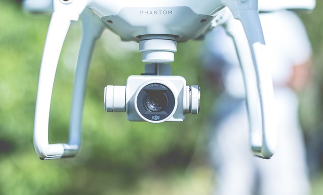
Most widely available consumer drones like the DJI™ Phantom come equipped with standard RGB cameras.
What RGB sensors can help with:
Faster field scouting
Traditional crop scouting involves gas-guzzling ATVs, trucks, or tractors; driving through your fragile fields; and walking to manually observe plants and find problems. With an RGB camera on your drone, you can see your entire field in one place by processing aerial imagery into an orthomosaic map, quickly make observations, enter the geodata into your GPS, and drive right into the problem area without damaging your entire field.
Use standard RGB imagery to save time and improve field scouting by identifying and going straight to the source of the problem without disturbing healthy crops.
Asset inspection
Drones empower you to fly and capture imagery or live video from a higher vantage point so you can inspect assets safely. Use drones with RGB sensors to inspect assets such as grain bins, barns, or other buildings and equipment more efficiently and effectively.
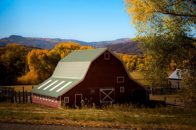
Use drones to perform aerial inspections of barns, buildings, and other assets around your farmstead. (Photo by Nathan Anderson on Unsplash.)
Approximate crop health
Some farmers have used an index that works with RGB sensors called Visible Atmospherically Resistant Index (VARI) to detect areas of crop stress. The VARI algorithm uses some color correction to minimize reflectance, scattering, and other atmospheric effects to better estimate the fraction of healthy vegetation in an area. Effectively, it exaggerates color and shows how green the plant is in comparison to others so you can approximate plant health and vigor. VARI is not a replacement for the Normalized Difference Vegetation Index (NDVI), but it can be useful if you only have an RGB camera which cannot process NDVI imagery.
The VARI index compares and adjusts the red, green, and blue bands of light to display an approximation of overall crop health.
NIR-enabled cameras
Near-infrared (NIR) sensors capture light invisible to the human eye. There are two types: Multispectral cameras which capture Red, Green, and NIR light and Modified RGB Cameras that are enhanced to capture NIR as well as RGB light. NIR sensors are more expensive than RGB sensors, but let users do much more.
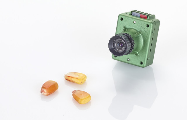
This compact, high-precision sensor from Sentera captures NIR for NDVI processing.
What NIR sensors can help with:
You can do everything with an NIR sensor that you can do with an RGB sensors and more.
Process NDVI imagery
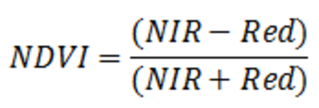
Normalized Difference Vegetation Index (NDVI) is one of the best indices for evaluating crop health and NIR sensors are necessary to measure it. NDVI mathematically compares red and NIR light signals to help differentiate plant from non-plant and healthy plant from sick plant. NIR sensors and drone software make it simple for agronomists and farmers to benefit from NDVI by creating maps that convert the ratios of invisible NIR light into colors humans can see and quickly evaluate.
.png)
When performing the calculation above, NDVI values will range from -1 to 1. The higher the index value (more positive), the greater the crop health and vigor.
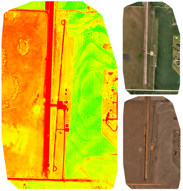
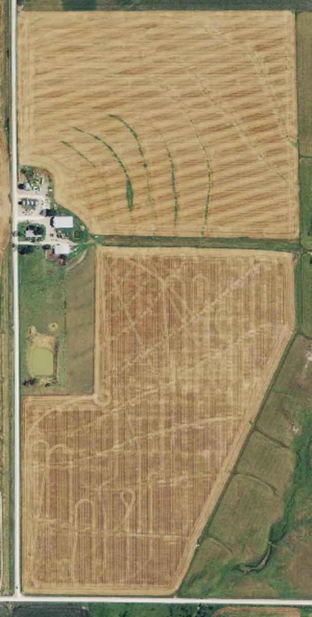
An NDVI orthomosaic map of an airstrip and nearby field (left) are made from a combination of RGB (top right) and NIR (bottom right) imagery. NDVI image processing makes variations in crop health more apparent than standard RGB imagery can.
Gather accurate crop health data over time
VARI can vary. Puns aside, VARI is not normalized for variations in sunlight, cloud cover, shading, etc., which means flying a field from one day to the next could reveal very different results. Even if you fly half your field at dawn and the other half at high noon, the results might not be comparable.
Because it incorporates NIR, NDVI by contrast is normalized for such variations, making it a better tool to compare the health of your crops over time, whether it be week to week, month to month, or even season to season. Comparison is an important part of agronomists work in order to improve crop yields, so NDVI is a necessary tool for the job.
Identify problems sooner
Plants show stress in NIR sooner than the visible light spectrum which means that you can detect even the slightest crop stress, days or up to weeks before you’d be able to with the naked eye or an RGB sensor. NDVI mapping helps you detect problems sooner so you can take action to improve crop health before it becomes detrimental to your yields.
Create variable prescription maps
NIR sensors create NDVI maps that you can upload to agriculture software like Ag Leader® SMS™ or agX® SST to identify variability in your fields. Your agronomist uses these software tools to generate prescription maps of your fields, showing you exactly where to seed and spray with variable rate applications that save you money and resources, while improving crop yields.
How Botlink assesses crop health
Botlink prefers NIR sensors because we want to give you the best data you can get and provide you with the most accurate indication of plant health every time. NIR sensors create NDVI maps that detect problems sooner and help you make more accurate comparisons throughout the year or season to season.
Botlink doesn’t use VARI for crop health because we don’t believe it adds significant value beyond what a standard RGB orthomosaic shows. In some cases, VARI data can be even harder to evaluate than standard RGB, creating more problems than solutions.
Debunking the myth of synthetic NDVI
While searching across the web, you have probably seen the terms “synthetic NDVI” or “false-NDVI” which refer to an NDVI algorithm applied to RGB imagery. It’s called false-NDVI because it doesn’t collect NIR light that NDVI normally requires, and instead uses RGB images to approximate NDVI. We don’t recommend using false-NDVI as it reports inaccurate data that can be detrimental to your crops.
If someone points you towards false-NDVI, we suggest looking at the other options mentioned above. The VARI algorithm is a more useful and accurate way to measure plant health using RGB imagery. If you can get an NIR sensor, we always recommend true NDVI as your best option.
We recommend NIR sensors and true NDVI for the most timely and accurate assessment of your crop health. Fortunately, you can probably purchase an NIR sensor for less than you think.
How do I get an NIR sensor?
RGB sensors are easy to find on consumer drones, while NIR sensors are found on specific drones or have to be added on. We have affordable options for anyone looking to purchase a drone with an NIR sensor.
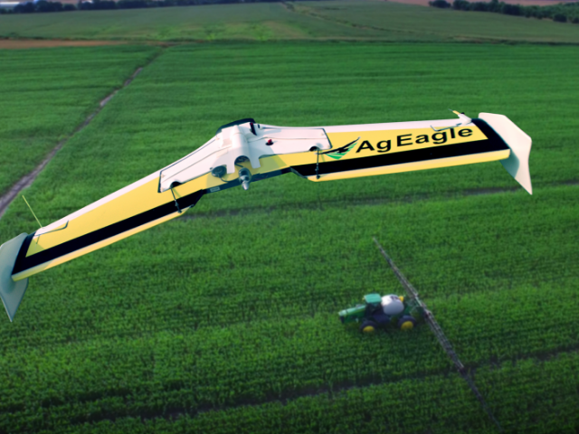
AgEagle fixed-wing drones come standard with Sentera NIR sensors.
Sentera even has an upgrade for common DJI™ drones which will work with the Botlink Capture app.
Also check out our drone bundles and get one year of Botlink Professional image processing services included.
Ground truthing your drone data
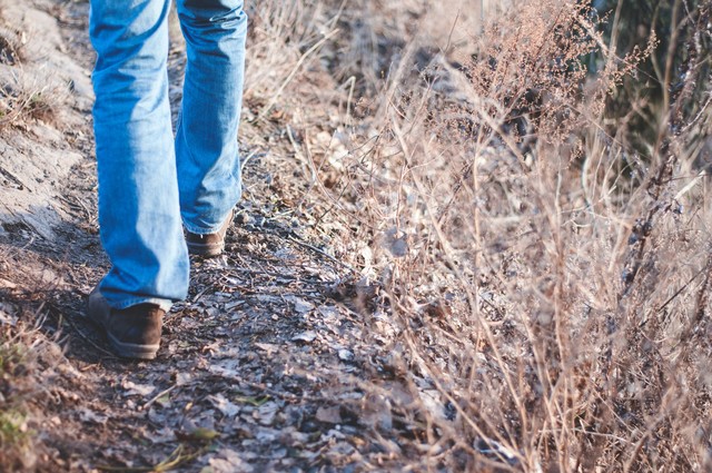
Drones and ground truthing make your farm operation more efficient and effective while improving yields.
While drones make field scouting faster and more effective, they can’t replace it all together. Using the algorithms to measure the plants shows the variability, but it can’t tell what causes that variability. That’s why no matter what method or calculation you use, it’s always important to ground truth and take samples. Once the variability is found, put on some boots, go right to the source of the problem, and determine the best course of action.
About Botlink:
Our mission is to build the best UAV platform on the market by pairing industry-leading hardware with easy-to-use software giving our users the power to perform smarter drone operations anywhere.
Botlink is a software system that enables users to quickly & safely capture data using drones, distribute that data to trade tools and react to changing conditions in real time. Botlink integrates with existing industry analysis tools such as Procore® and AgLeaderSMS, giving them easy access to their drone data in their existing business discussion making process.
The content & opinions in this article are the author’s and do not necessarily represent the views of AgriTechTomorrow
Comments (0)
This post does not have any comments. Be the first to leave a comment below.
Featured Product